
The park WiFi will be unavailable until further notice.
Parking is only allowed in designated parking spots. Please observe all rules distributed by rangers when entering the park. Use caution as flooding is possible.
Trails
 Sutherland Wash - Catalina State Park
Hiking Trails
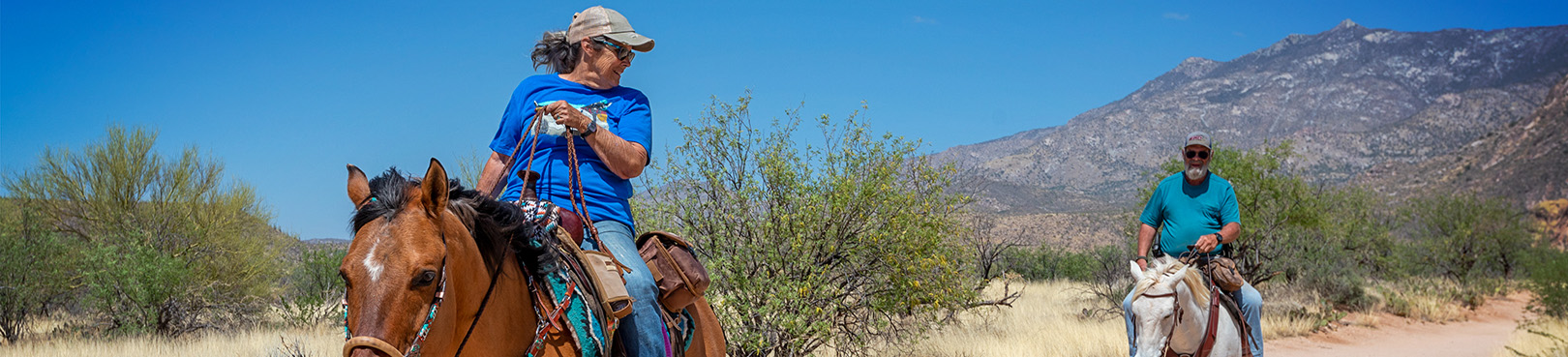
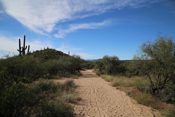
At Catalina State Park, you can hike, take a horseback ride, and bicycle on the trails, surrounded by the towering Santa Catalina Mountains. There are eight trails at the park, varying in length and difficulty, but all with amazing views. Leashed dogs are welcome on all trails. All eight trails are multi-use except Romero Ruins. Before your trip, learn about the various desert plants and wildlife that you will encounter in the park, then pick up a copy of our free trail guide at the Visitor Center. All that's left to do is get out there and enjoy the adventure!
Romero Ruins Interpretive Trail
0.75 mile, loop — no bikes, no horses
This easy loop trail begins south of the main road across from the second pull-out. The trail crosses a seasonal wash (feet may get wet) before climbing about 80 steps to the hilltop. The Romero Ruins archaeological site includes the surface features of the remains from a Hohokam village dating back to about 500 A.D. Trailside signs address the archaeology of the site, the Hohokam culture, and the Romero homestead. Plan on 30 minutes of walking time. For the protection of cultural resources, no collecting is allowed. Tour the trail.
Nature Trail
1.0 mile, loop — no horses
Another easy loop trail. The Nature Trail begins at the trailhead parking lot, climbs a hill, then meanders through low foothills with typical desert scrub vegetation. Trailside signs feature local plants and animals, in addition to climate and geology information. Plan on 45 minutes of walking time. Tour the trail.
 Birding Trail
1.0 mile, loop — no horses
This easy loop begins at the trailhead parking lot. The trail crosses a wash (with seasonal water flow) then loops up and down the foothills. Desert scrub, mesquite bosque, and riparian vegetation are seen with trailside signs highlighting the relationships between unique bird species and their preferred habitat. Plan on 45 minutes of walking time. Tour the trail.
Bridle Trail
1.4 miles, one-way
A flat, easy trail connects the Equestrian Center with the trailhead parking area. Plan on 45 minutes each way. Tour the trail.
Canyon Loop Trail
2.3 miles, loop
Easy hike through the foothills that begins and ends at the Trailhead parking lot. The loop is created by a link connecting the Romero Canyon Trail and the Sutherland Trail. The trail is relatively flat, but about halfway around there is a slope with approximately 90 stairs. There is a bypass trail around the steps for horses. Plan on 90 minutes of walking time to complete the loop. The Canyon Loop Trail crosses a wash several times, so seasonal stream flow may result in wet feet. Tour the trail.
Sutherland Trail
9.1 miles, one-way — no dogs in Desert Bighorn Sheep Management Area — no bikes in Wilderness Area
The first few miles are easy hiking. Beginning at trailhead parking lot, the trail gradually climbs 700 feet. Plan on 90 minutes of walking time from the trailhead to park boundary. After one mile, the trail weaves in and out of the park and the Coronado National Forest (including the Desert Bighorn Sheep Management Area and the Wilderness Area, which is closed to dogs and bicycles respectively). There is a 2.2-mile trail link on the north end of the park that connects the Sutherland Trail with the 50-Year Trail. Continuing on Sutherland, this difficult trail climbs through Cargodera Canyon with a steep and rocky ascent to roughly 8,600 feet elevation ending at the Mt. Lemmon Trail (to Mount Lemmon). The total elevation gain is 5,900 feet. Tour the trail.
50-Year Trail
8.6 miles, one-way
A moderate trail that is especially popular with equestrians and mountain bikers. Trail begins at the park’s equestrian center and follows a ridgetop for 2.6 miles. A 2.2-mile trail link connects the 50-Year Trail with the Sutherland Trail. Or after leaving the park, the trail continues for six miles through open desert. The terrain is up and down through the foothills with a few hundred feet of elevation gain. Plan on four hours of walking time each way for the entire 8.6-mile length of this trail. Tour the trail.

Romero Canyon Trail
7.2 miles, one-way — no dogs in Desert Bighorn Sheep Management Area, beyond Montrose Pools — no bikes in the Pusch Ridge Wilderness — not recommended for horses beyond Montrose Pools. Tour the trail.
Progressively difficult trail. Montrose Pools and Romero Pools are shallow catchments on canyon streams that flow seasonally. Start at the Trailhead parking lot and cross Sutherland Wash, which flows seasonally. The first mile is a relatively flat and easy walk to Montrose Pools (usually dry) and the park boundary. The next 1.7 miles is a steep and rocky climb to Romero Pools. Poor trail conditions might be encountered as this is an unmaintained wilderness trail. From the Trailhead to Romero Pools is 2.8 miles with an elevation gain of 900 feet. Plan on two hours of walking one way from the Trailhead to the pools.
To continue to Romero Pass, follow the trail to your right as it ascends out of the streambed. The trail then slowly climbs up-canyon 4.4 miles to Romero Pass at 6,000 feet elevation. From the Trailhead to Romero Pass is 7.2 miles with an elevation gain of 3,300 feet, about a five-hour hike one way. Romero Canyon Trail ends at Romero Pass, where it intersects Mt. Lemmon Trail (to Mt. Lemmon) and West Fork Sabino Trail (to Sabino Canyon).
Arizona hiking trails can be found throughout the State Park system, and many of them are pet friendly! With trail options available statewide, you can always find an adventure!
Want More AZ Hiking Info?
