

Maps
Park Location and Directions
What3Words: ///fidget.payout.dragon
Colorado River State Historic Park Map
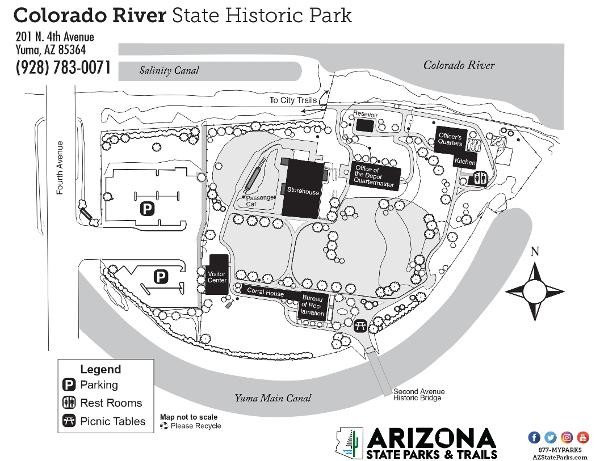
Download Printable Park Map
Park Map shows you an overview of the park.
Elevation
120 ft
GPS Coordinates to park entrance
Decimal Degrees (WGS84)
Latitude: 32.727202
Longitude: -114.624481
Degrees, Minutes & Seconds
Latitude: N32 43 37
Longitude: W114 37 28
GPS
Latitude: N 32 43.632
Longitude: W 114 37.469
UTM 11N
X: 722618
Y: 3623541
