

Maps
Park Location and Directions
What3Words: ///cover.pounces.regulated
Oracle Park Maps
Download Printable Park Map
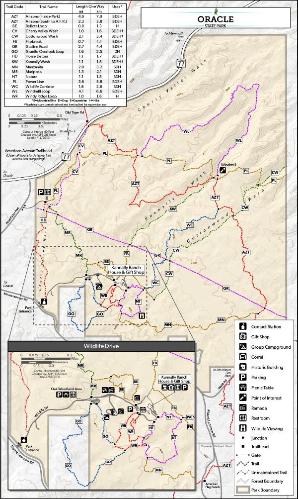
This map gives an overview of park amenities and hiking trails found at Oracle State Park. Basic guide to the trail system. The trail map is intended as a guide only. Persons planning to use the longer trails should carry a topographic map.
Click to enlarge map
Elevation
4500 ft
GPS Coordinates to park entrance
GPS
Latitude: N 32 36.360
Longitude: W 110 44.865
